NISAR’s First Radar Images Capture Maine’s Coast and North Dakota’s Farmlands in Striking Detail
NASA has released the first radar images from its newly launched Earth-mapping satellite, NISAR.
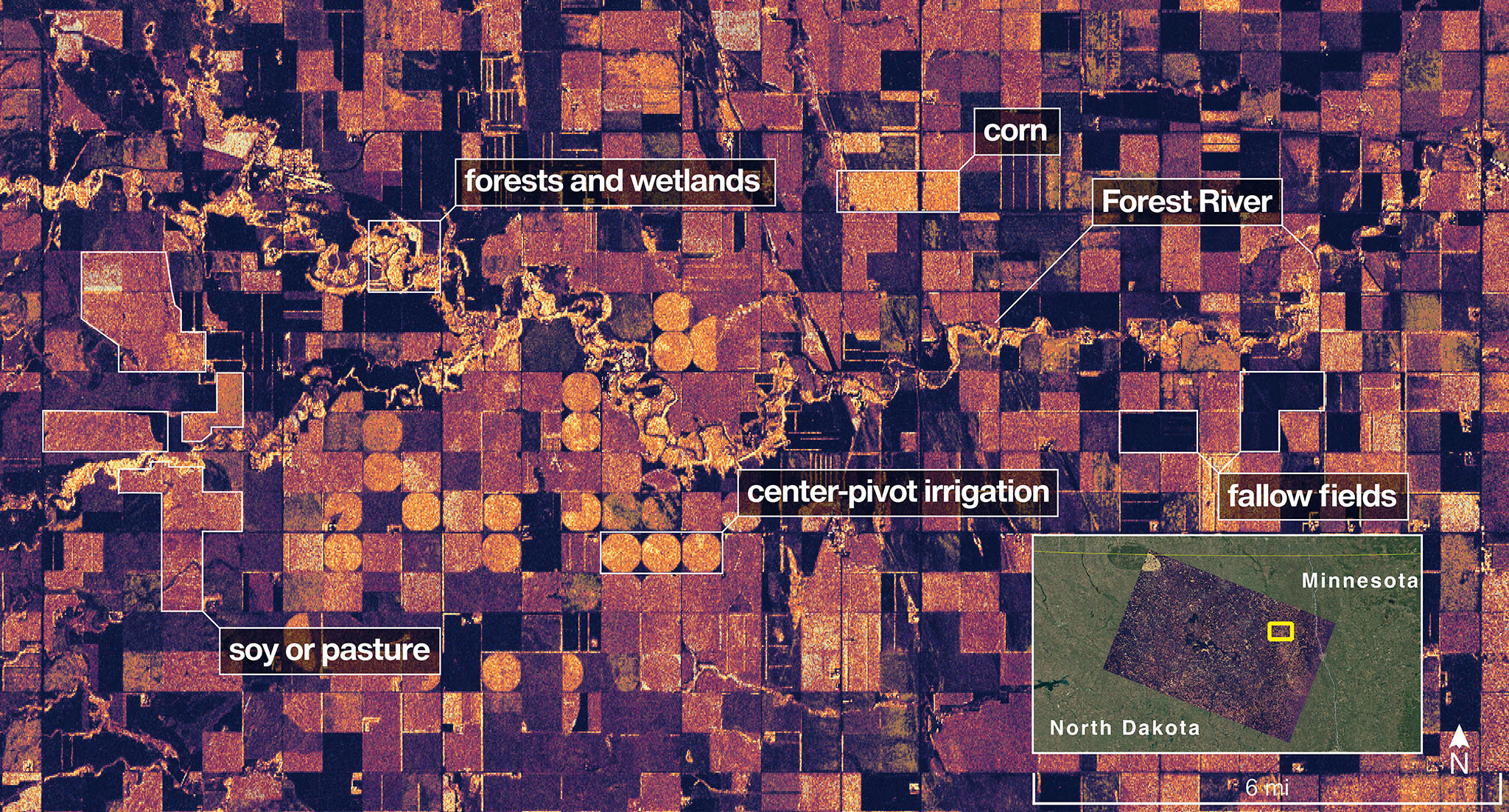
The pictures showcase the rugged Maine coastline and farmlands of North Dakota, revealing features in extraordinary detail. A $1.3 billion joint mission with the Indian Space Research Organization (ISRO), NISAR is designed to survey nearly all of Earth’s land and ice repeatedly, offering transformative insights for climate science, disaster forecasting, and environmental monitoring.