Mapping Tianshui’s Folk Fortresses Reveals How Landscapes Shaped Community Defense in Northwest China
Key Takeaways (10 Theses)
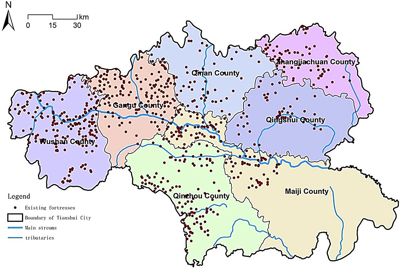
Extensive Mapping Effort
Researchers identified 718 historical folk fortresses in Tianshui, Gansu Province, using field surveys and geographic information technologies.
Grassroots Heritage
Unlike state fortifications, these fortresses were built by local villagers during times of war, banditry, and unrest to protect their communities.
“Land of a Thousand Fortresses”
Tianshui has long been known for its dense concentration of folk defensive settlements, but until now, they lacked systematic academic study.
Cultural Landscape Database
The project created Tianshui’s first fortress cultural landscape database, including four sub-databases on fortress entities, environment, geography, and historical records.
Average Size and Spacing
The fortresses average 5,338 square meters in area and are typically located about 2.3 kilometers apart.
Clustered Distribution
High-density clusters were found in Tongwei, Wushan, and Gangu counties, with hotspots of up to 17 fortresses per 100 square kilometers.
Topography Shapes Design
Fortress shapes vary with terrain: circular structures on hilltops, elliptical ones along ridges, and irregular forms on rugged ground.
Force Transmission Chain Model
Researchers developed a framework linking natural conditions, agricultural productivity, population capacity, and settlement distribution to fortress placement.
Symbols of Resilience
The fortresses represent more than defense—they embody community resilience, adaptation, and survival strategies in challenging environments.
Future Preservation and Tourism
Findings provide both theoretical insight and practical guidance for cultural preservation, offering new opportunities for heritage tourism in the region.
2025-09-11 11:13:41